
The trip originated after many months of Nivi and I musing over going someplace far for a few days. Plan after plan would be made and scrapped as weekend after weekend would pass. If your heart is not really into it, any task, it would seem takes forever. First it was work, then it was something else and then something else until I decided that it was just too late in the season. If we did not go right now, Fall would merge into Winter and all plans to go anywhere will be for nothing. The original plan was for us to go to Glacier National Park in Montana. By the time we had finalized the timeframe in which we wanted to go, some portions of Glacier National Park had already closed for the season. Nivi wanted either everything or nothing from Glacier National Park, so I had to come up with another destination. Hmm, we had 10 days for our vacation, so we could go on a long roadtrip. Let's go to Yellowstone I said one day. Nivi nodded and we had converged on Yellowstone. The rest of the planning took about a week. I bought the following stuff for the trip:
|
|
|
|
|
|
|

|
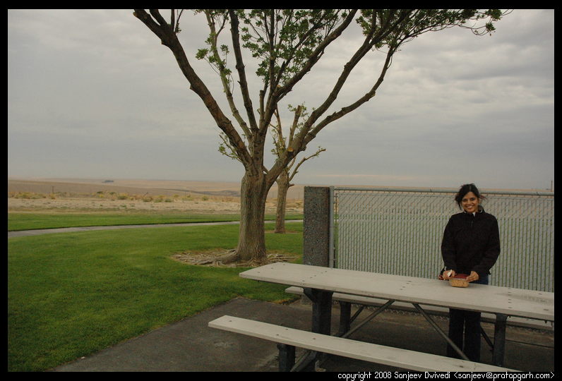
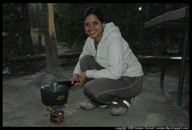
Quickly leaving that place, we were back on the road. It was nearing lunch time
by this time and we had not had a proper breakfast (except for munching some
trail mix), so we decided to cook something. We found a rest area with picnic
 tables. It had been raining throughout the way, so it was necessary to get some
shelter from the rain to get the stove going. A few picnic tables at this rest
area were covered with a canopy, so we set our stove there and quickly cooked
some Pulav (rice dish) in our pressure cooker. We were running late so we
decided to keep the hot vessel in our car and drive to the next rest area.
Hopefully, by then, the cooker would have cooled enough and released the
pressure and we could eat. After driving for about 70 miles to the next rest
area, we got out. It was drizzling still and I was glad that we had bought
some sturdy rain jackets before leaving. We ate at this rest area and moved
along. The rain was kind of annoying but because of it, the scenery was
incredibly beautiful, like out of a movie. There were low clouds all over, the
trees were yellow and red, there were lakes and rivers by our side making the
drive very pleasant.
tables. It had been raining throughout the way, so it was necessary to get some
shelter from the rain to get the stove going. A few picnic tables at this rest
area were covered with a canopy, so we set our stove there and quickly cooked
some Pulav (rice dish) in our pressure cooker. We were running late so we
decided to keep the hot vessel in our car and drive to the next rest area.
Hopefully, by then, the cooker would have cooled enough and released the
pressure and we could eat. After driving for about 70 miles to the next rest
area, we got out. It was drizzling still and I was glad that we had bought
some sturdy rain jackets before leaving. We ate at this rest area and moved
along. The rain was kind of annoying but because of it, the scenery was
incredibly beautiful, like out of a movie. There were low clouds all over, the
trees were yellow and red, there were lakes and rivers by our side making the
drive very pleasant.
|
Clouds coming from Seattle were chasing us as we tried to outrun them. Finally, towards night (~7:00pm), we managed to reach Lewis and Clark State Park. It was desolate, it was dark, it was windy... and not a soul in sight. No, literally, not a soul in sight. Every single campsite was free. The only light visible was coming from the restroom. Gusts of wind were chilling us. It was a little unnerving to be in wild country without anyone there. We were trying to make up our mind whether to camp there or not and I told Nivi that we should at least prepare our dinner there and in the meanwhile air out our tents as they had gotten wet the night before. We lay our tent flat on the ground and found some shelter to light our stove. "What do you want to eat?", I had earlier asked. "Pasta", came the reply without any thinking, so pasta it was. After we prepared and ate the Pasta, we reconsidered our options. Camping or motel? I was a little unsure, but Nivi seemed a bit terrified with all the warnings of "Bears frequent these campgrounds...", so I decided to look for a motel for the night. We found "Rocker Inn" in Butte, MT where we spent the night.
|
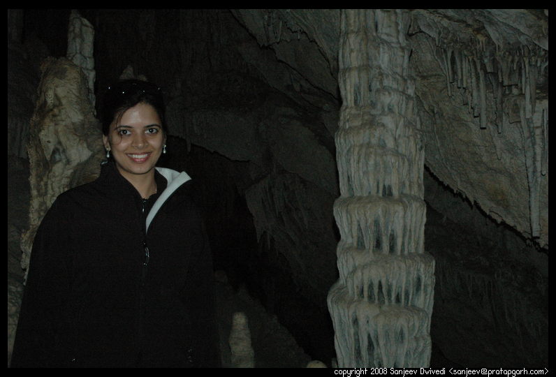
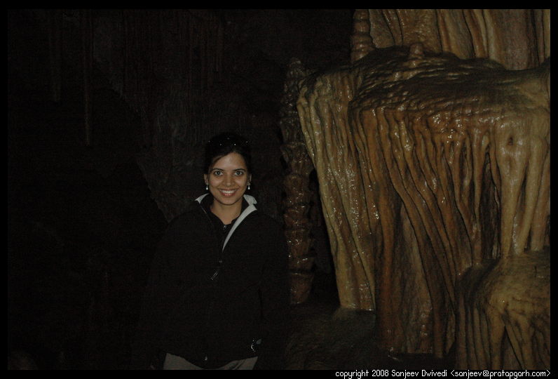
After Nivi got spooked a little bit at the Lewis and Clark Caverns state park, what with no one being present at the campsite when we arrived in the dead of the night, we spent the night at Rocker Inn motel in Butte, Montana and in the morning got up at about 8am. I wanted to show Nivi the campground which in the night seemed so inscrutable in the light of the day. We also wanted to take a look at that park, so after packing up and a short drive later, we were at Lewis and Clark caverns state park again. The campground did not look even remotely scary in the light of the day. We went up to the visitor's center and met the park rangers. They were going to conduct a tour of the caverns and were charging $10 per head for the guided tour. Since Nivi had never been inside a cavern, we decided to take the tour.


|
The Lewis and Clark caverns, despite mentioning Lewis and Clark by name, does not bear any relation to the real explorers. They never visited the park area or the caverns. The US president who instituted the park named it so to honor the explorers. Anyway, in the caves we went and all daylight left us within the first few meters. The guide seemed to know the caves and in general the history of the area pretty well. Apparently the caves were accidently discovered by a guy called John Morrison. He and another guy saw steam coming out of a hole in the ground and decided to investigate it. The steam was caused by the temperature difference between the air inside the caves and the ice cold air outside. Jim Morrison popularized the caves and led (illegal) tours for the rest of his life into the caves while the state government sat on its hind not doing anything about it. Eventually, the state took help from the Civil Conservation Corps (CCC) and developed the site for public use. Although probably Jim Morrison could be honored for doggedly pursuing people to use the site and in the end getting the park created, he also caused a lot of damage to the caves as he would ask the visitors to take souveniers from the site and over time they broke off hundreds of thousands of rock formations from inside the caves.
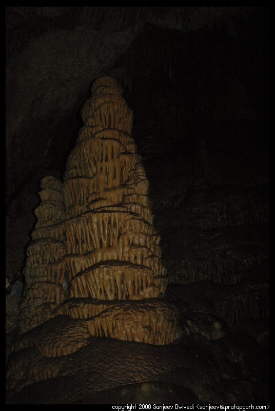
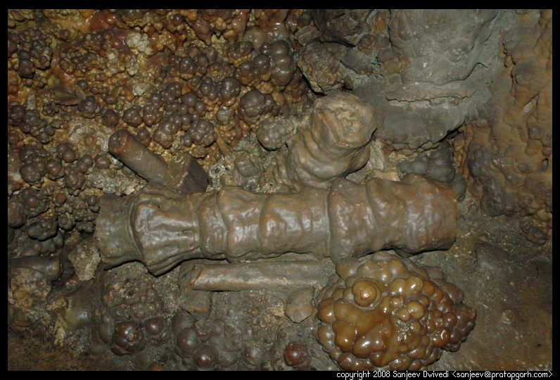
Coming back to the point, the caves themselves have been formed from water running through the crevices deep inside earth. Water, as it passes through the ground, dissolves limestone and as it drips from an opening down below, starts forming stalactites and stalagmites. The caves were full of these rock formations in a lot of curious shapes. There were small stalactites and stalagmites far apart and where the two had joined, there were pillars in very interesting shapes. The way this particular cave was organized was that there were roomy areas, aptly named Rooms, connected by narrow and in some cases, low ceiling passages. Sometimes we had to bend in weird ways and at one point of time, we had to sit down and slide. There are many kinds of formations in the caves. There are structures called popcorns as that is how the formation looks like. There are pillars that formed in tiers. Each tier is marked with small stalactities on all sides, making it look like an elaborately carved pillar. There were formations that looked like folded curtains and so on. There was even a small crystal blue pool by the side of one of the rooms.

|
The tour took us down and down, deeper and deeper in the caves and when we finished, someone in the group asked, "Oh, now we gotta climb all the way back up." The guide smiled. The genius of the development was that the climbing back was not required. Even before we entered the cave, we had to hike about a mile on a gentle slope to the cave entrance. When we finished, we were about the elevation of the beginning of the trail. The engineers at CCC had devised this clever strategy. To get out of the cave, they blasted out the rock and formed a tunnel to the outside of the mountain. Once they had blasted the tunnel however, they found that a huge draft of wind started entering the tunnel and started drying out the cave. To avoid the draft, they fitted a huge thick door to the caves. However, what they found that was that with the powerful wind, it would become impossible to open or close the door. So, they adopted a two door airlock design. To exit, you open the inner door, get in the tunnel, close the door behind you and then walk to the front door. You open the front door and since there is nowhere for the air to go (as the rear of the tunnel is locked already), it is easy to open and close.
Anyways, the helpful ranger was talking with us and when he heard that we were going to Yellowstone, he suggested a few things and even provided us with a map of Montana and the suggested highway to get there.
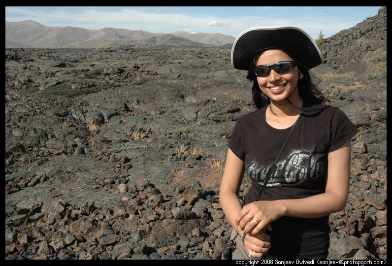
I must mention here all the things that had already gone wrong on the trip so far. The worst went wrong just at the beginning of the cave tours. My trusty Nikon D70 camera decided that it was the perfect time to malfunction. In the viewfinder it would show a blue spot in the cener and sort of yellowish glow all around it. It would not meter properly, i.e. even in reasonably good light, it would behave as if it was already midnight and the lens would not auto focus. That was a big bummer as I had come to rely on this camera very much and I did not have any backup with me. I tried everything that I could think of and even looked at the manual that I had carried. It very unhelpfully mentioned that if "the camera is not auto focusing", I should "manually focus it". Frustated, I had switched the focus to manual and was sort of guestimating (guess-estimating) the correct metering. The silver lining in all of this was that the camera was still functional and taking pictures.
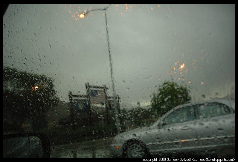
Finally, close to mid afternoon we started on our journey towards Yellowstone national park. We drove and the rain and foul weather that we brought with us from the west had already caught on with us. Heading towards Yellowstone on the lonely Montana highways, we could see dark clouds looming in front of us and in almost no time, heavy rain hit us. I was doubtful of the forecast that claimed a 30% chance of precipetiation and clearing of the sky towards the evening. Nivi was particularly apprehensive after witnessing rain at Heyburn state park. Although we did not get wet at Heyburn and we slept pretty comfortably, packing the tent was a mess as it was wet and cold.
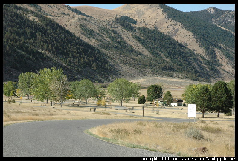
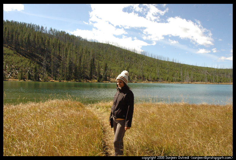
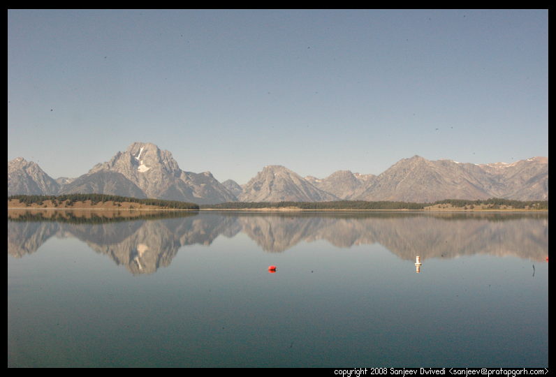
The thoughts of motels and cabins were on our minds when we were at the entrance station at Yellowstone. "Are we gonna freeze to death tonight?" and "Which campground is best for this weather?" is what I asked the ranger at the entrance station. She smiled and said, "well Mammoth Springs campground is the warmest campground in Yellowstone." So, off we went to Mammoth springs. On the way itself, the scenery was breathtaking. The fall colors had already started showing and the views were spectacular. When we reached the campground, there were plenty of other tents around, which gave us some comfort. I quickly reached the campground reservation desk and stood in line to get a campsite. I got the last campsite (Number 84) in Mammoth Springs campground and the booking window closed with a "campground full" sign as soon as I was done.
|
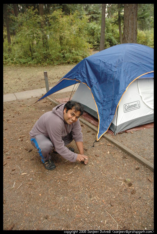
The weather was still looking gloomy but it was not raining, so we started setting up our tent. Earlier research on the internet had by now made its mark on my mind. The footprint under the tent (i.e. the tarp, the sheet of plastic you put under your tent to keep the tent floor from getting dirty), should be about a inch smaller than the actual floor of the tent. I had read this on the Internet during my research, but had not realized its importance. The rain in Heyburn made me realize the truth behind this. If your tarp is bigger than the tent floor, it will extend beyond the floor. Rainwater will fall on the tarp and pool on it and flow beneath your tent, where slight amounts of water will seep through the tent floor. This time, I was not willing to make the same mistake. Although my tarp was much bigger than the tent, I folded the ends until the tarp sat about an inch under the tent on all the sides. We started setting up the tent and while we were setting up the poles to make the tent stand, it started drizzling. "Oh Shoot!", I thought and we quickly got the tent up, by this time it started drizzling somewhat more heavily. "Lets put on the rainfly in a hurry", I shouted at Nivi and she brought the rainfly up. I put the rainfly on top of the tent so no water would get in. It was then that we started tying it up. By now the rain was getting pretty hard. My stakes were not in the ground and I was afraid that the wind would collapse my tent to the ground. I had previously experienced the collapse of a tent during rain in Florida and I was not willing to relive that experience. We were both getting wet, so I asked Nivi to go sit in the car. I put on my rain jacket and went ahead setting the stakes and tying the tent to the ground. By the time I was done, my pants were partially soaked. The tent however was standing its ground in face of the wind and the rain. After about 20-30 minutes the rain started easing up and in the distance we could see the clouds breaking up. Once the rain stopped, we put an additional rainfly on top of the tent. This rainfly is from a bigger tent that we have and acts almost like a full rainfly for our tent (a full rainfly completely covers the tent versus a half rainfly which only covers the meshes in the tent.) When the rain finally abated, we were somewhat soggy, but getting dry pretty quick.
We set our sleeping arrangement in the following order.
We would sleep inside layer 5 with two layers of fleece on our bodies. Nivi would put on a woolen cap (I had a drawstring hood in my fleece) and we would both put on woolen socks. With this configuration we did not feel any cold whatsoever except for the exposed part of our body (the face.) I was somewhat disappointed in the Mountain Hard Wear sleeping bag in that if layers 6,7,8 would get dislodged, we would start feeling cold in temperatures much over 20.
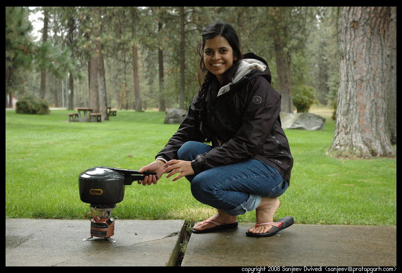
Anyways, coming back to the story, we were not up to cooking a whole lot as we were beat with cold and rain and were ready to go to sleep. So, I first cooked rice on my trusty stove and then we opened a packaged curry (MTR brand) that we had bought from the Indian store as emergency ration. The rice and the curry was OK but the the paneer (cheese) in the dish tasted like solid rubber.
Finally, we went to sleep. I woke up several times in the night to sound of wind and rain on my tent.
It rained all night but by the time we woke up, sun had finally come out and the sky had cleared. I walked around the tent assessing the damage. Inside, the tent was perfectly dry and we were cozy and warm. Outside, however was a completely different story. As I looked at the top rainfly, first I saw flecks of ice on it. Then I saw more ice and then even more ice. It went much below freezing in the night!! The whole rainfly was covered with Ice (not snow). I shook the rainfly this way and that and the ice crystals flew in my face. Nearby a fellow camper was doing the same.
But the sun was out and it was a whole new day.
 We got up nice and warm and apart from the ice on the tent, there was no sign of
the bad weather the previous day. We brushed and prepared some Poha (a dish made
of flattened rice and veggies) for breakfast. The plan was to cook something
else for the lunch. This plan was flawed to begin with as was evident later in
the evening as we ended up missing our lunch. It was later in the trip that I
realized that it is better to spend time in the morning preparing food and doing
other odds and ends than spend time on such things once you are out and roaming.
We got up nice and warm and apart from the ice on the tent, there was no sign of
the bad weather the previous day. We brushed and prepared some Poha (a dish made
of flattened rice and veggies) for breakfast. The plan was to cook something
else for the lunch. This plan was flawed to begin with as was evident later in
the evening as we ended up missing our lunch. It was later in the trip that I
realized that it is better to spend time in the morning preparing food and doing
other odds and ends than spend time on such things once you are out and roaming.
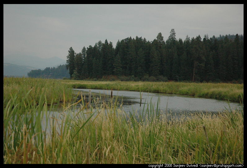
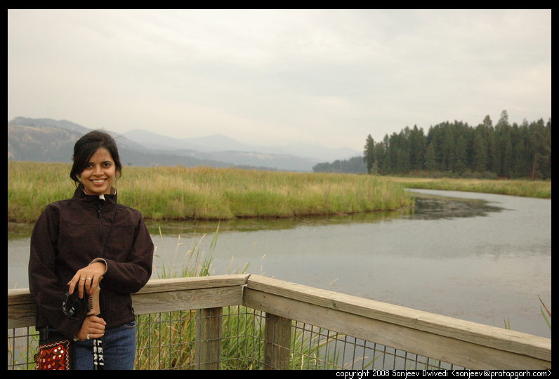
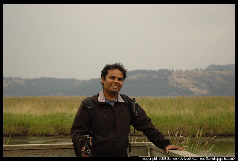
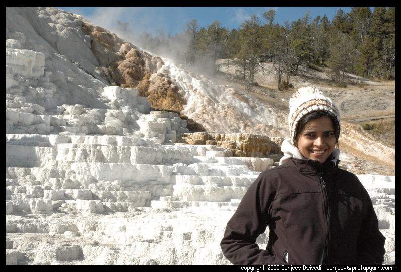
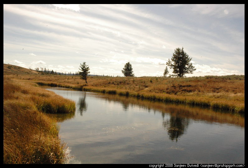
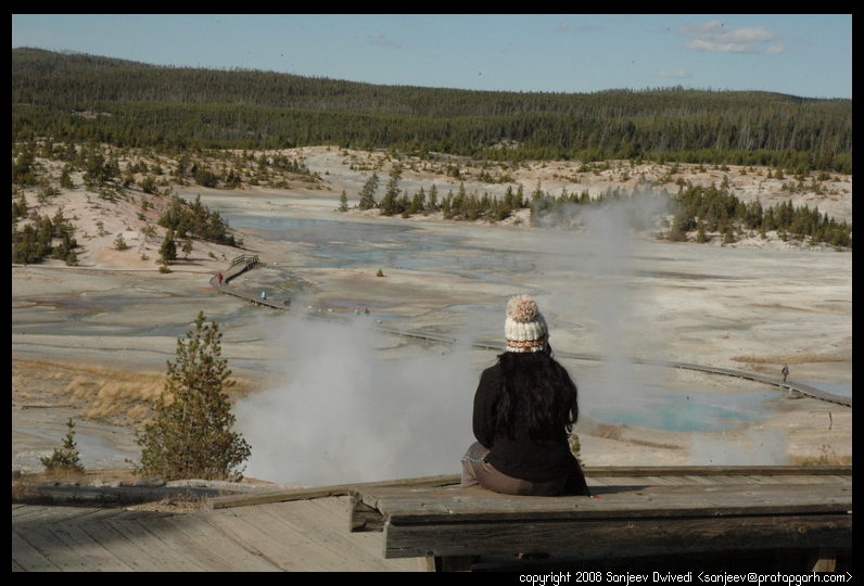
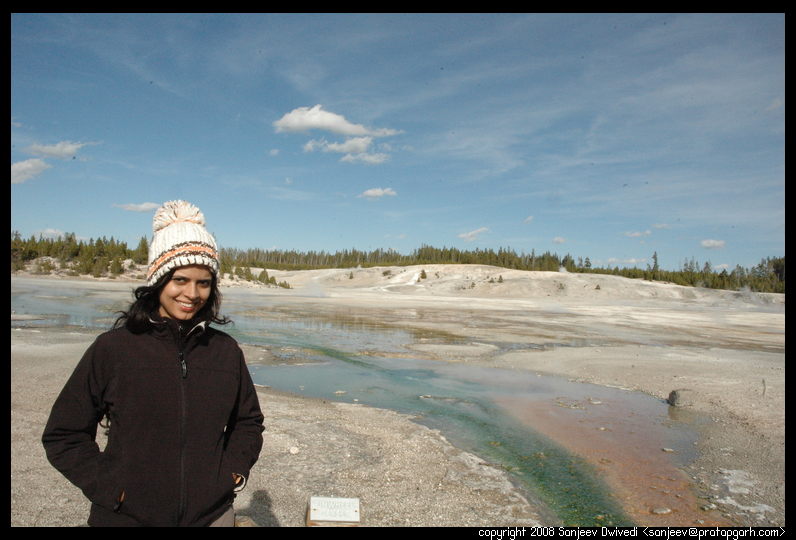
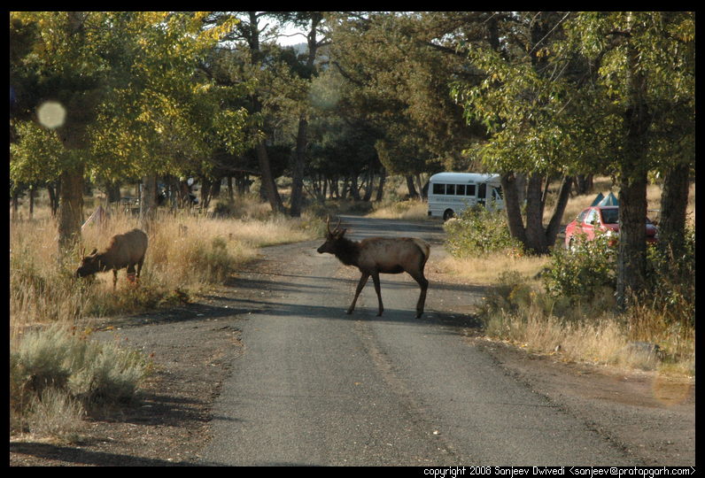
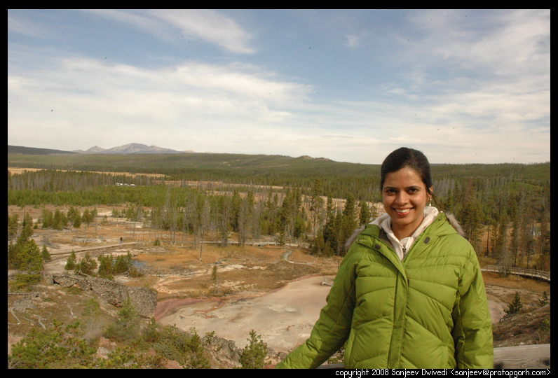
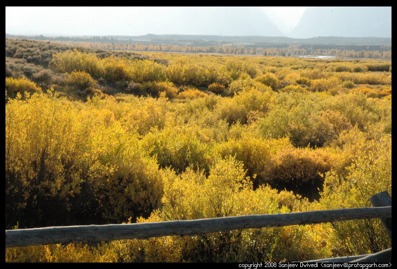
Anyways, we had our warm breakfast and headed out for the nearest destination, the Mammoth Hot Springs. A huge heard of elk was roaming all over the Mammoth Springs hotel and resort and the traffic had slowed down as people were trying to take pictures of elk. This was elk mating season, so it was prudent that people keep their distance, but people being people, were often throwing caution to wind. The park rangers would keep warning people to stay back. We had seen elk the previous day as they were roaming around our campground so these elk were nothing new. We arrived at the Mammoth Hot springs and decided to walk around the boardwalks to see all the springs and structures that the springs had created.
|
|

|
|
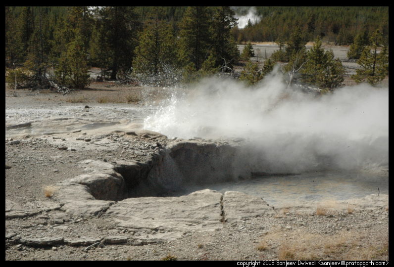
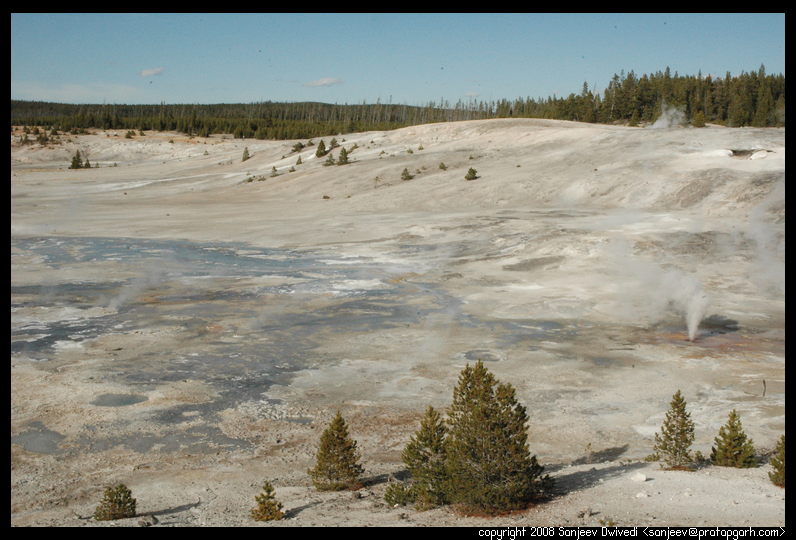
 As we approached Norris basin, we were getting somewhat hungry, but not hungry
enough. We had brought some emergency ration in form of home made trail mix
(made by mixing raw cashews, almonds, raisins and walnuts) and
all of a sudden, we found ourselves munching on these things. Norris basin has
two loops. One is on a higher altitude than the other. The first loop
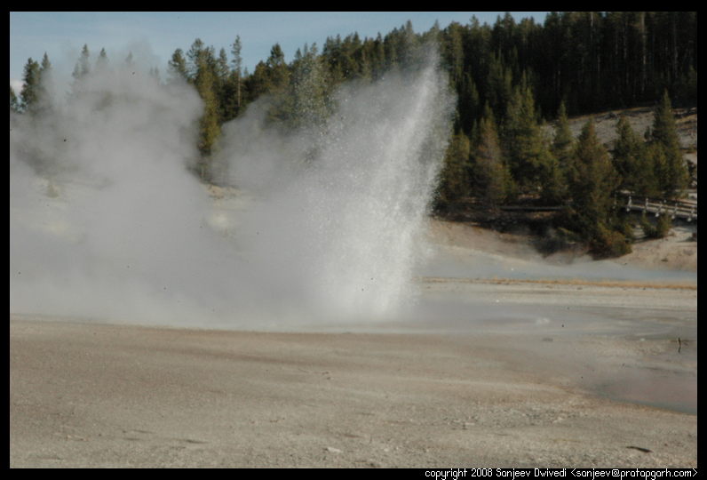
was a huge area full of boiling pools of water and steam hissing out of the
ground. Standing around one of these pools was quite difficult owing to the
amount of sulfurous steam that was coming out of them. In certain places, if you
stood for a minute or more, you could come out damp, moist and choking. We walked along
and saw quite a few geysers. One of them was boiling pretty violently and would
spew large amounts of water every now and then. As we walked around and came
back to the place where the water from this geyser was flowing downhill, we
noticed that the water would periodically increase in intensity. That explained
the deep furrow in the middle of the rather largish area where this water was
flowing from.
As we approached Norris basin, we were getting somewhat hungry, but not hungry
enough. We had brought some emergency ration in form of home made trail mix
(made by mixing raw cashews, almonds, raisins and walnuts) and
all of a sudden, we found ourselves munching on these things. Norris basin has
two loops. One is on a higher altitude than the other. The first loop
was a huge area full of boiling pools of water and steam hissing out of the
ground. Standing around one of these pools was quite difficult owing to the
amount of sulfurous steam that was coming out of them. In certain places, if you
stood for a minute or more, you could come out damp, moist and choking. We walked along
and saw quite a few geysers. One of them was boiling pretty violently and would
spew large amounts of water every now and then. As we walked around and came
back to the place where the water from this geyser was flowing downhill, we
noticed that the water would periodically increase in intensity. That explained
the deep furrow in the middle of the rather largish area where this water was
flowing from.
|
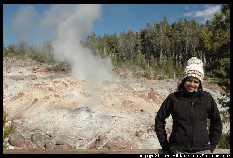
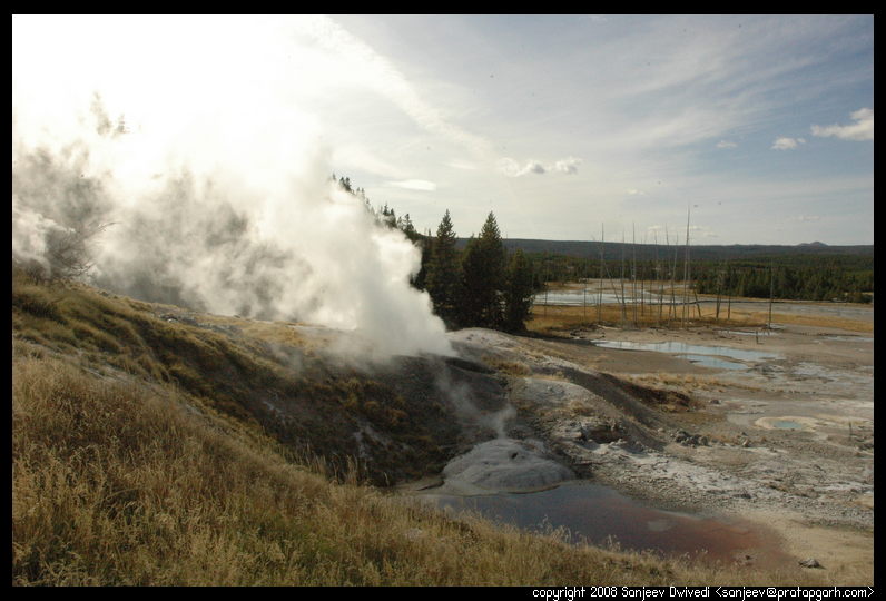
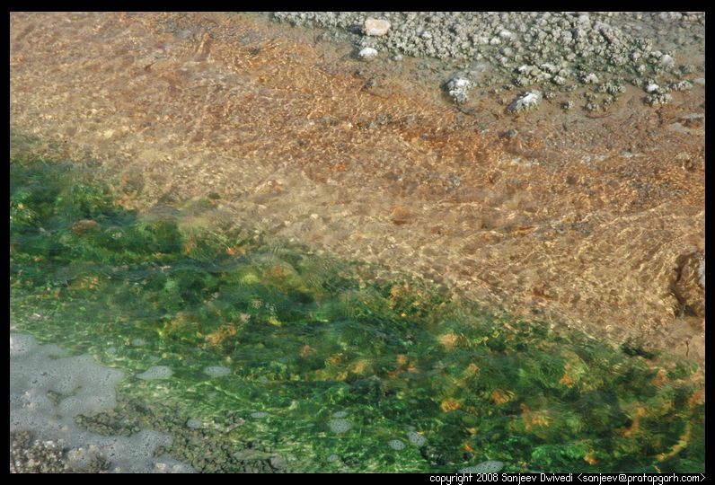
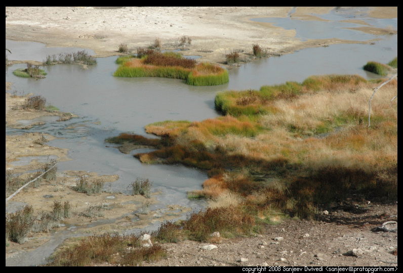
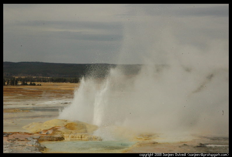
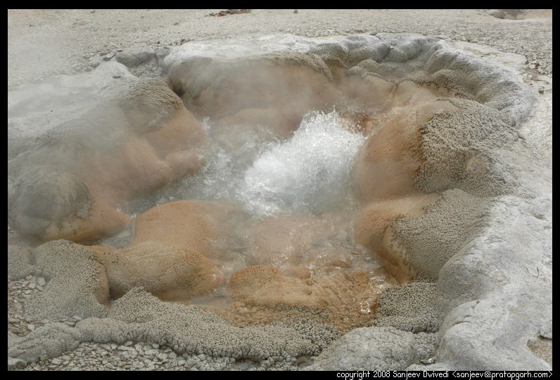
This area was pretty violent in general as was evident by the amount of sulfurous steam that it produced and in the intensity of the water spewing out of the ground. Compared to this, the other loop, rather lower in altitude seemed more tame. As we entered this loop, two huge plumes of steam were rising from the ground, but not much water seemed to be boiling beneath them. We walked down the trail which passed through a rather flat area. Thermopiles -- heat loving bacteria -- had grown colonies and mats of themselves in this area and had given brillint green and orange streaks of color to wherever the water flowed.
|

|
Next, I wanted to show Nivi the Grand Canyon of Yellowstone, and we drove up there. However, we got a little confused by the time we reached there and the daylight was giving way to night, so we went to buy some supplies that we had forgotten to bring at the Canyon village grocery store. We bought a can opener for the cans we had brought, muffins for Nivi and a few disposable plates and headed back to the campground.
We reached the campground with some light to spare. I lit the stove, opened two cans of kidney beans, two rather smallish cans of tomato paste and made some curry. As I tasted the curry, I came to the conclusion that tomato paste is an awful substitute for tomato. Tomato puree or even diced tomato would have been better. The curry tasted way too sour but that is what we had prepared (and a ton of it too, for the next day lunch.) Once we were done cooking rice too, we had our dinner and headed inside the tent for the night. The sky was clear with no clouds in sight. The forecast for the next day was clear with a lot of sun. We were happy and we dozed pretty soon.
Before we had left Seattle, the forecast for the day of 20th was cloudy with a bit of rain but the rest of the week was forecast as being clear and sunny. Living in western Washington, I don't really trust the weather forecast that much, and that too one week advance weather is something I cannot digest, but I was sort of glad of the forecast. When the day of Sep 24th arrived, it took away all our doubts. The weather was bright as a shiny new penny. Bright sunlight hit our eyes when we got out of the tent and crystal blue skies welcomed us.
 The day before we had attempted to go to the Grand Canyon of the Yellowstone
and had come back from the Canyon Village instead. One of the culprits towards
that was that we got up pretty late. This day however we hurried up a little
to be on the road earlier. Along with the morning ritual, the ritual to
prepare food had automatically entered my system. So, while Nivi rummaged
through our supplies to get some noodles out, I started the stove and put the
water to boil. We have a special kind of noodles in India called Maggi.
Basically it comes with a small packet of spice that you put in the boiling
water, let it simmer for a little while and then put the noodles in it. Let
the whole thing simmer for a few minutes and you have spicy noodles ready. I
am not particularly a fan of these noodles as they are just pure white flour
and there is no veggies or protein in them. Thus, they don't sustain me for
more than an hour or so. Nivi is gaga over them, so well, here we were making
noodles. While we were cooking, two young bull elks were nibbling at leaves at the tent
site nextdoor. These elk were relatively young and their horns had not
completely formed. They were still molting. They would nibble a few leaves, look
here and there and then continue on their way.
A quick gobble later, we were ready for the road.
The day before we had attempted to go to the Grand Canyon of the Yellowstone
and had come back from the Canyon Village instead. One of the culprits towards
that was that we got up pretty late. This day however we hurried up a little
to be on the road earlier. Along with the morning ritual, the ritual to
prepare food had automatically entered my system. So, while Nivi rummaged
through our supplies to get some noodles out, I started the stove and put the
water to boil. We have a special kind of noodles in India called Maggi.
Basically it comes with a small packet of spice that you put in the boiling
water, let it simmer for a little while and then put the noodles in it. Let
the whole thing simmer for a few minutes and you have spicy noodles ready. I
am not particularly a fan of these noodles as they are just pure white flour
and there is no veggies or protein in them. Thus, they don't sustain me for
more than an hour or so. Nivi is gaga over them, so well, here we were making
noodles. While we were cooking, two young bull elks were nibbling at leaves at the tent
site nextdoor. These elk were relatively young and their horns had not
completely formed. They were still molting. They would nibble a few leaves, look
here and there and then continue on their way.
A quick gobble later, we were ready for the road.
We had not showered the day before because according to my understanding from the NPS Yellowstone website, the campground with showers was quite a bit further. The park newsletter that we had picked while entering Yellowstone however listed our campground as having showers as well. When I inquired about it, I was told that the campground itself did not have showers, but the hotel a little bit further had them. At the hotel, after paying the $3.50 per head for shower, Nivi's mood had completely lifted. "I feel like a new person", she told me, "Uh-huh", I proclaimed and taking care not to get in the way of all the elk that were roaming around, we started towards the Grand Canyon of the Yellowstone.
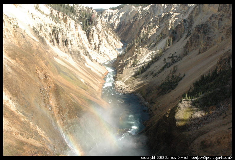
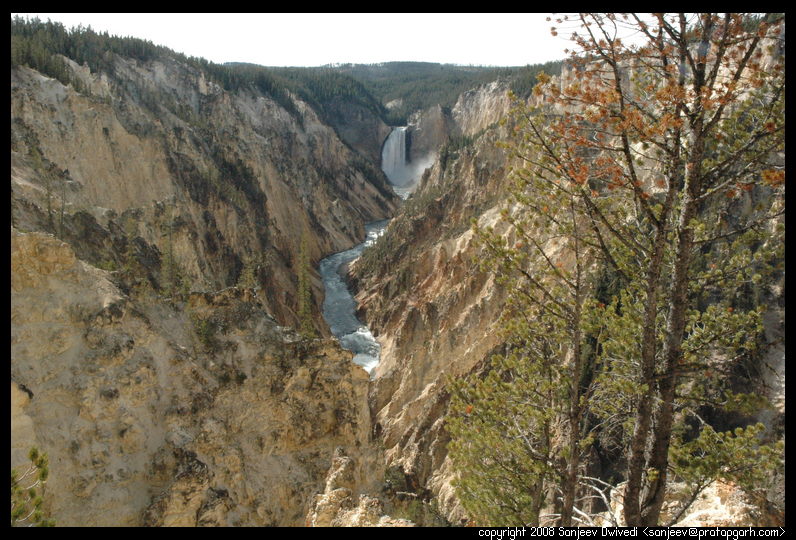
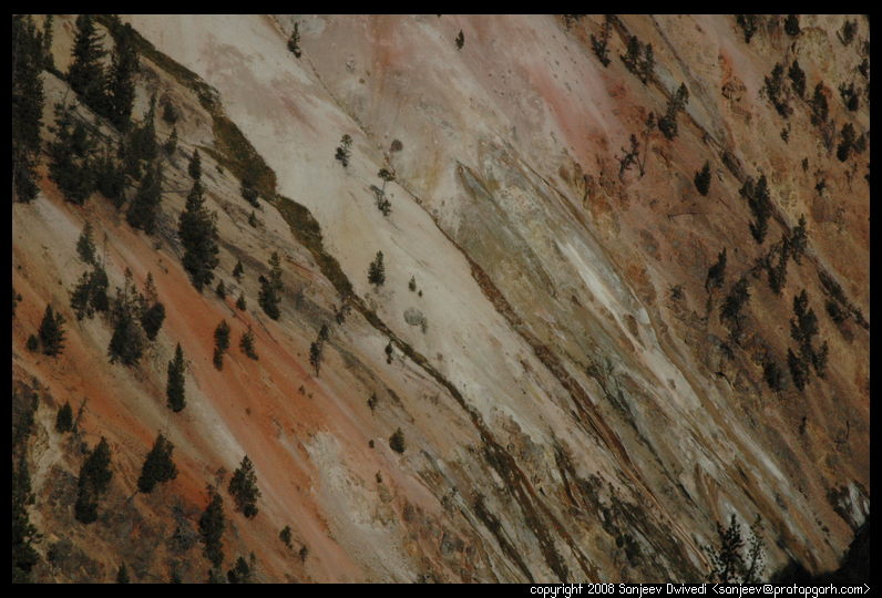
After much driving, we finally reached the canyon at the upper falls. The Yellowstone river flows through the canyon and over time has made a pretty deep gorge through it. The rock of the canyon is multi colored and has owing to the rather steep walls has sparse vegetation. The river has two waterfalls as it winds it way through the canyon. The first fall in my opinion is a bit shorter than the second and is called the Upper Falls and the the second obviously is called the Lower Falls. The last time I had visited Yellowstone, there were drives and hikes on both sides of the canyon. The drives are respectively called the North rim drive and the South rim drive. The north rim drive was very pretty, but it was closed for maintenance. What a bummer. However i coaxed Nivi into a 2 mile hike from the Upper Falls to the Lower Falls. Most of the hike was simple with not much elavation gain, but towards the end, the hike goes down to the falls very sharply. It is a Zig-Zag path that takes you from the top of the mountain to the top of the falls in almost a vertical line. Getting down was easy and the view was spectacular. The canyon walls would start out drab, convert to yellow and blend into orange every so often. The mist from the falls would capture the sunlight and form multiple rainbows. Truly a sight to behold.
|
Going back up this hike required some effort. But, once we reached back, we were back in the car and driving to the south rim drive content. There were not a whole lot of hikes and not a whole lot of time for us to hike, so we mostly stayed at vistas and viewpoints. I was beginning to comprehend the immensity of the scale of Yellowstone. Even with doing just the boardwalks and small hikes and looking at outlooks, viewpoints etc, it was taking a lot of time. The three days that we had allotted to Yellowstone were not sufficient even to scratch the tip of the iceberg. Well, as a friend once said, the first trip is exploratory. This trip had give us our first taste of a long roadtrip, camping outdoors, cooking our food on the stove, being in the wilderness and meeting interesting people. The day before when we were at the Norris Geyser basin, we had gone to the Museum of the Ranger. It had showcased the life of the earliest ranger to the evolution of the modern day ranger. We also met a ranger Jo-Ann Morris over there. When talking to her, we quickly figured out that she was a volunteer, volunteering for two weeks. "Ah, so I have to become a volunteer to get a cool pin like yours that says NPS volunteer?" was what I said. "Here you can have it", she said and handed the pin to me. I was sort of baffled, but she insisted that I have it. One more souvenir of the trip and the people I had thought.
 Anyway, coming back to the day, we drove on the south rim drive of the
canyon, and clicked some pictures. It was time then to go visit the lower
part of the grand loop. "It is going to stink of sulfur pretty bad soon",
I told Nivi, and pretty soon, we could smell the rotten eggs smell through
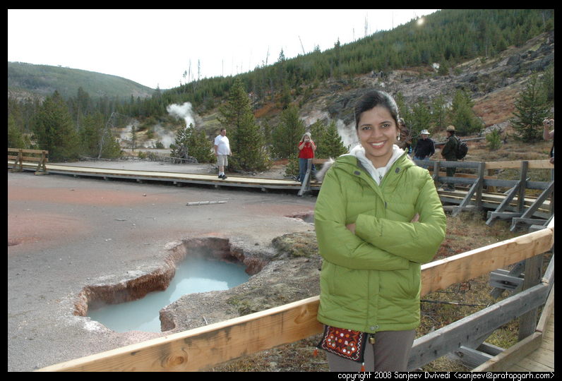
closed windows of our car. I stopped the car at the Sulphur Caldron and we
went out to look at it. The viewpoint was by the side of the road and the
sulphur cauldrons were at much lower height. You could see a huge yellow
pool, bubbling away merrily and sending out the sulphur fumes. In the
distance, steam hissed through a hole in the ground. That was Nivi's first
look at a bubbling sulphur stream. The streams at Mammoth Springs are
neither so sulphurous, nor so huge.
Anyway, coming back to the day, we drove on the south rim drive of the
canyon, and clicked some pictures. It was time then to go visit the lower
part of the grand loop. "It is going to stink of sulfur pretty bad soon",
I told Nivi, and pretty soon, we could smell the rotten eggs smell through
closed windows of our car. I stopped the car at the Sulphur Caldron and we
went out to look at it. The viewpoint was by the side of the road and the
sulphur cauldrons were at much lower height. You could see a huge yellow
pool, bubbling away merrily and sending out the sulphur fumes. In the
distance, steam hissed through a hole in the ground. That was Nivi's first
look at a bubbling sulphur stream. The streams at Mammoth Springs are
neither so sulphurous, nor so huge.
 We continued on south towards Mud Volcano. Mud volcano is actually
probably one of the most violent thermal areas in yellowstone as there
are a lot of geysers that spew mud, water and steam from them. The
caption there read, "For a few days the mud volcano shook as earthquake
after earthquake hit it." That was a few years back. The mud volcano area
had about 500 earthquakes in about a week. The landscape changed pretty
significantly. The original mud volcano had blown itself apart during the
earthquakes.
We continued on south towards Mud Volcano. Mud volcano is actually
probably one of the most violent thermal areas in yellowstone as there
are a lot of geysers that spew mud, water and steam from them. The
caption there read, "For a few days the mud volcano shook as earthquake
after earthquake hit it." That was a few years back. The mud volcano area
had about 500 earthquakes in about a week. The landscape changed pretty
significantly. The original mud volcano had blown itself apart during the
earthquakes.
All this while we had been getting hungry. We had prepared some kidney
bean curry the night before but we needed to prepare fresh rice to go
with it. Where do I light my stove? Is a picnic area ok? Is it even
allowed? I had seen signs saying no fire at picnic areas, but I was not
sure. I was not lighting a fire for sure, a compact stove would probably
be ok is what I was rationalizing to myself. Then I thought again, "Well
backpackers do use stoves in the wilderness", so that should be probably
ok. I was thinking of asking some park rangers this question just to be sure when
we happened to come upon a bunch of them. I talked to the most
impressive looking one. "I know it says no fires in picnic areas, but
all I have is a small backpacking stove. Would it be ok to light it at
one of the picnic areas?" He looked at me and said, "That should be ok,
I think. You see, there are multiple enforcement authorities at
Yellowstone. We are Geologists and then there are law enforcement
here as well. So if you start the stove and a law enforcement tells you
that it is wrong, tell them that a Geologist told you that they thought
it would be ok. So that way, we get in trouble and not you." "Thanks so
much", I said. We smiled and we were on our way. Soon, we found a
somewhat secluded picnic area by a river and set down our stove and
cooked some rice. A hearty lunch later, we were back on the road and
looking at the scenery.
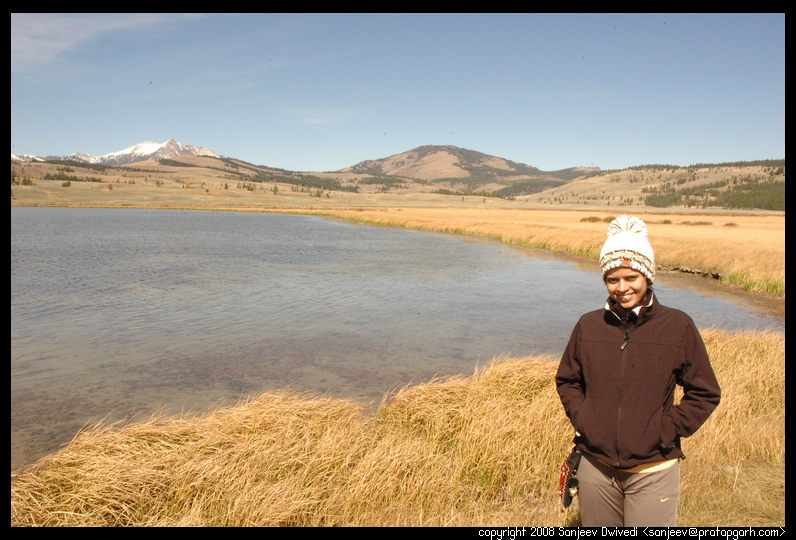
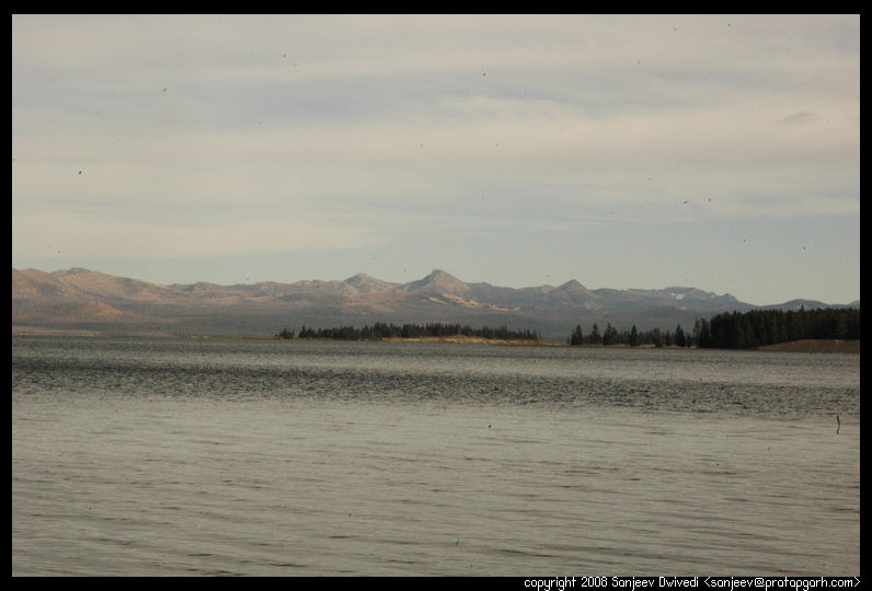
We drove by the Yellowstone lake as Nivi kept Ooh-ing and Aaah-ing at the size and scenery. The Yellowstone lake is an immense lake with mountains in the backdrop and a few islands in the middle. The vegetation on the islands is quite different from the vegetation on the mainland. I told nivi that the Lake village and the Bridge bay have views of the lake but not much else, so we had decided to forego them. Seeing the lake however, the usual blaming started, "You did not take me to the lake", she started blaming. I would much rather avoid any blame for the future, so I took a detour towards the end and stopped at a place where there was a clear access to the lake shore. We took some pictures there and sat there for a few minutes admiring the grand lake. On the road, towards the end of the lake, we spotted what looked like a huge fork of land delving deep into the lake. It had created a small backwater on one side of the lake. So the lake was effectively divided. The majority of the lake was on one side and a small backwater on the other side. Looking at this oddity, we stopped and walked there for a few minutes too.
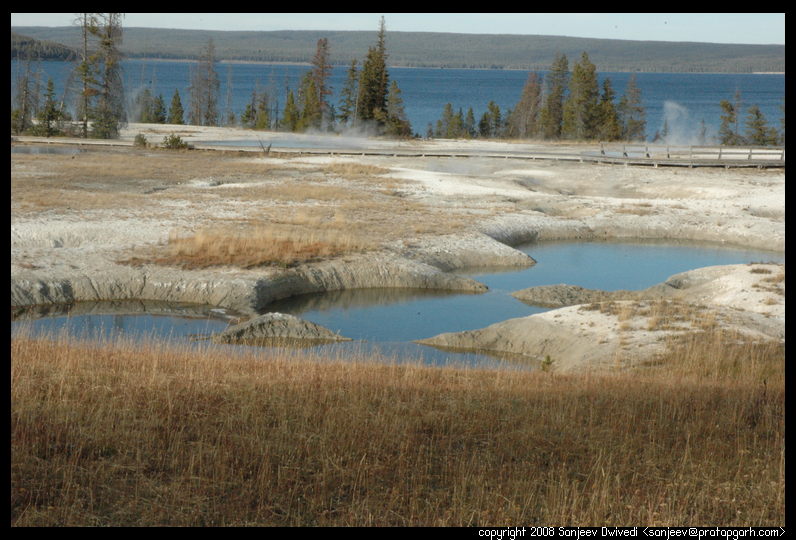
The sun was getting somewhat low by now, so on we continued towards West thumb. West thumb is again a geyser basin, but the interesting thing about it is that it is very close to the yellowstone lake. In fact some of the cones and small geysers of this basin are right inside the lake. It is just amazing to see how something as tranquil as the Yellowstone lake is actually actively simmering in places.

|
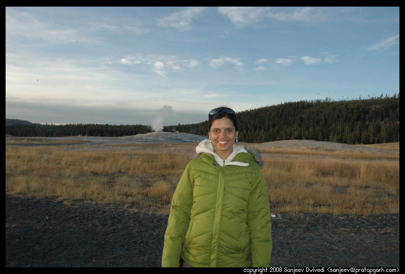
By the time we left west thumb the sun was getting pretty low. It was
already almost 5:30pm and there was still almost 30-40 minute drive
to the Old Faithful geyser. Nivi was not sure we would be able to see
anything, but I wanted to make a dash for it. We had only one more
day to go at Yellowstone and I wanted us to maximize the use of the
daylight. On the road we were and much driving later we finally
arrived at the Old faithful. There were very few people there and the
visitor's center was closed. A notice in the window claimed that the
next eruption would be within half an hour. Considering the old
faithful erupts every 90 minutes, I considered ourselves lucky to
shave off the extra 60 minutes that we would have had to wait if we had arrived right after an eruption.
We sat there and waited for the old faithful. Nivi wanted "before,
during and after" pictures with the old faithful and I said fine.
During the eruption however, when I asked her to turn to have a
picture taken, she would get impatient. "Should I look at the
eruption, or should I pose for the picture" was her dilemma. Anyways,
we had our pictures and the grand view of erupting old faithful and
we started back on the road.
By this time it was pretty dark and all the beautiful scenery of the daytime had been converted to dark shadows and shapes. The only thing I could do was to concentrate on the long windy road. Driving the 40 miles or so too me slightly more than an hour, what with the posted speed limit of 45. Yellowstone is wild. The realization hits you more so often as you drive in the night. In the corner of the my headlight's light, I saw a coyote waiting to jump up on the road as my car whizzed by and then later a marmot like animal sitting on the road. I avoided both successfully and after much driving was back at our camp by almost 9:15pm. We had only 45 minutes to go before the quiet hours would set so we ran helter skelter picking up supplies, lighting the stove and cooking rice. We finished our dinner with the left over curry just in the nick of time. I washed the utensils in the bathroom sink as a ranger had advised for us newbies (experienced campers use a portable sink in which they wash the utensils and then discard the water in the toilet) and we headed in our tent for a night of rest and recharging for the next and final day at Yellowstone.
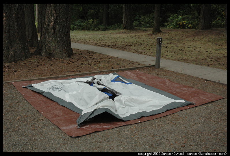
We had been attempting to improve our waking up and getting on the road time. This time we were up by 7:00am or so. I got up and told Nivi to get up and get refreshed so we could be on the road as quickly as humanely possible. By the time Nivi came back from the bathroom, I had already packed up all the sleeping bags and comforters. We broke tent and that is when I noticed that the under side of both our tent and the tarp was a wee bit wet. Instead of packing them straight up, I put them bottom side up on the bushes and started cooking our breakfast. It was Poha morning again. Nivi chopped the potatoes and I fired the stove up. By this day, we had become quite efficient at this morning ritual of preparing breakfast. When we had started the journey, everything was neatly and hence somewhat impractically packed. By the morning of 25th, all the ineffiencies in the packing were gone. The knives and potato peeler were placed together in a place where they were handy. The pressure cooker, the pan, the wooden spatula and the spoons were all put in a convenient location that would not be disturbed by the packing and repacking of the sleeping bags, tent and our clothes. This had streamlined our main tasks which were normally those of getting the stove and the utensils in/out and our camping gear in and out of the car.


|
By the time we had the food prepared, had our breakfast and cleaned our utensils, the sun was shining in the sky. The morning wind and sun had dried our tent and tarp out. We packed our tent, took a last look at our home of the last three nights and bidding the Mammoth Springs campground a fond goodbye, left. We drove and drove until we reached the Norris basin geyeser. We had already seen the Norris basin geysers, so we did not stop here. We continued on through the various geysers on the way. There were many small geyser basins on the way. Artist paintpots had really fine pasty mud bubbling whereas there were places where springs were boiling. We happened to see a really weird thing though close to one of the springs. It caught my eye and I pointed Nivi towards it. At first I saw one small dead bird, then another and then another. In about a circle of 2 feet diameter, there were about a dozen dead birds. All of the same kind. How did they die? Did they have a huge colony of nests and one night a spring/geyser erupt there?
|
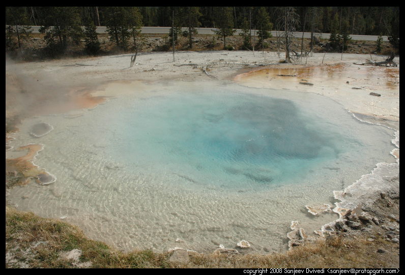
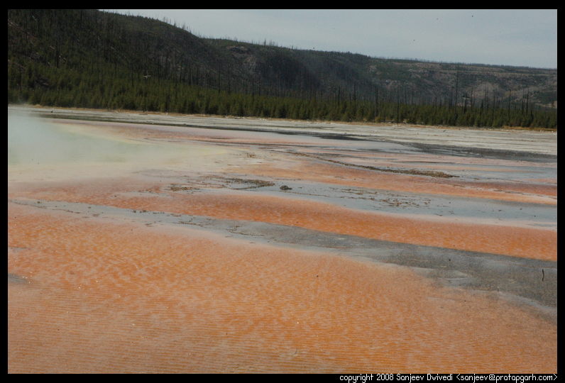
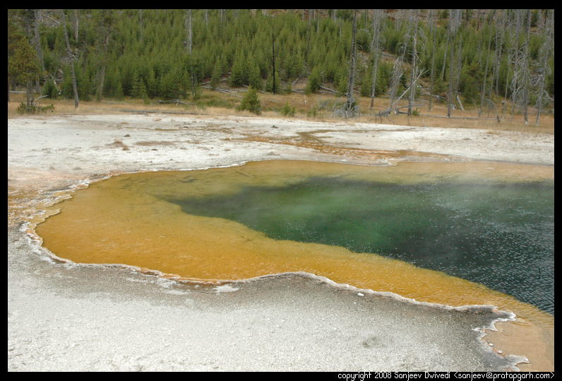
On this drive, there were two main highlights. One was the Grand Prismatic spring which is probably the single most beautiful spring at Yellowstone. Most days, it is covered with steam and is not visible but when the wind blows hard, you can see it once in a while. It is a medley of azure blue, orange, aquamarine and green colors. The springs here vent about 500 gallons of water a minute and it sure is visible in the gullies that it flows through. The wind here is exceptionally strong. I remembered it from the last time when I saw a few hats in the pool. And sure enough, I saw another hat, freshly fallen in the pool. I was just glad that our REI bought hats had strings and tieups at the bottom and that our hats were secure on our heads.

|

|

Coming out of these places we finally headed to the Old Faithful. By this time, it was already mid afternoon. We stopped at the Old Faithful and waited about half an hour for another eruption. Once the eruption had subsided, we started back on our road to the Grand Tetons.
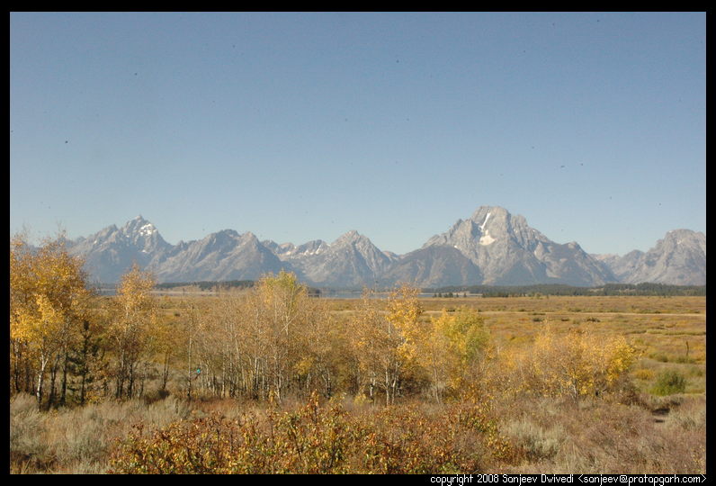
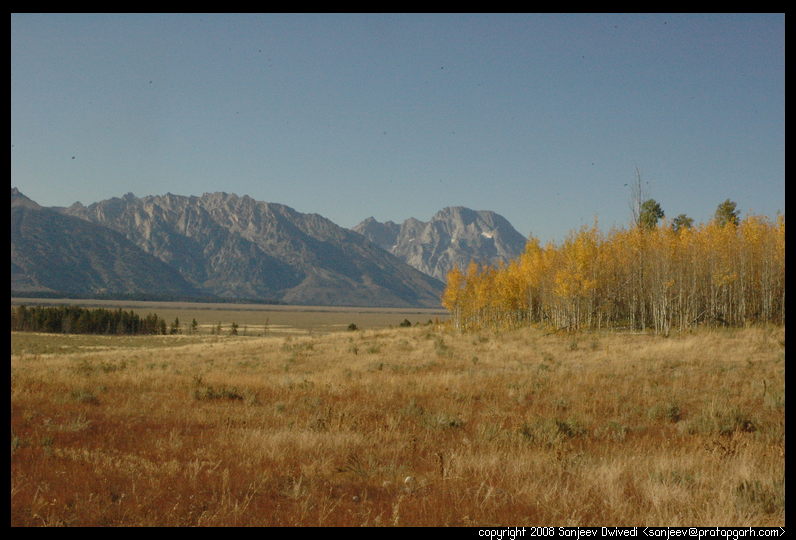
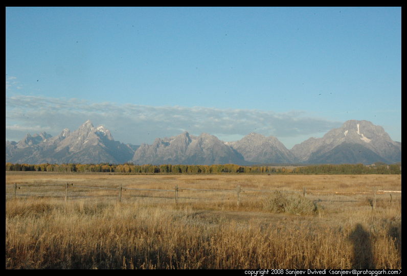
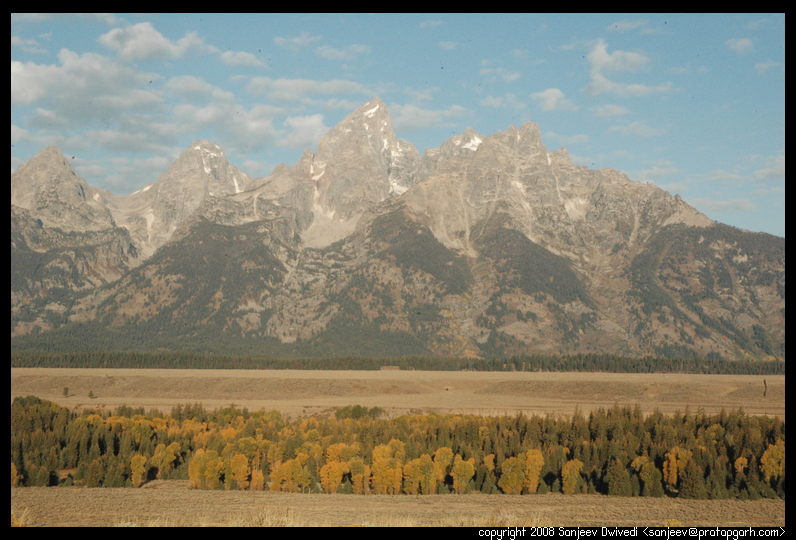
The road to Grand Tetons was mostly under construction and in numerous places, the work crew stopped and guided us. The distance that should have taken under 45 minutes took us more than an hour and half to drive through. As soon as we hit the Grand Tetons national park, our eyes dazzled with the brilliance of fall colors. The forest was colorful. A bright burning yellow and red in the evening sun. Nivi was getting excited. I asked if I should stop and take some pictures, but she did not have any energy left, so we kept going.
Finally, we reached the Colter Bay campground. I was a little concerned as it was getting late and I was thinking that we might not get a campsite. The ranger station at the campground was unmanned. There was a bunch of information there though. It said, if you came late, pay tomorrow. They had a lot of scary signs related to bears including a recent one where a bear had to be put down after it had gotten too aggressive. They had pictures of bears peeking through car windows. "Help us save a bear" and "It all smells to a bear" is what the signs said." The campsite was pretty huge. There were multiple loops. The season however was getting over and there were not enough people to fill even one loop. so they had closed down all the campsites except a single loop, loop B. We went around the loop and identified a good site. Site number 42. We parked our car and conferred for a while on where to put the tent. There was some shade under the trees but there were some young saplings there. Killing the saplings by putting the tent there just did not seem right, so we put our tents in a suboptimal place. Once the tent was taken care of, we sat down in the car and went on a ride. We rode around for about half an hour or more and then came back. We looked at the visitor center from outside and at the facilities including showers.
We had a late lunch this day and Nivi was not feeling very hungry. I, unfortunately, am always hungry when a meal time is there. So, I tried coaxing her into thinking that she was hungry. She would however not become hungry. So, I thought of cooking for myself. It, however was not very appealing to cook solely for myself. So, I looked at the leftover Poha from the morning. It looked extremely unappealing. Especially when it is cold, the Poha becomes uneatable. So I thought of heating it. I was in a hurry and I did not want the Poha to burn, so I poured some water in. Unfortunately, I poured too much water in. So, now I had two strata in the food. The liquidy strata at the bottom which was mostly water and the solid strata which was Poha. The liquid got hot pretty quickly but the solid did not. What to do? I put out the stove and cut chunks of the solid. I dipped it in the water and ate it. It was not appealing but at least it was warm.
I filled my stomach. I drank some water. At this campground, even waterbottles were not allowed in tents. "Remember, it all smells to a bear", is what the sign in the bathroom had said. I did not want a bear poking his head through my tent, so everything went in the tent. Nivi was already in the tent, sleeping peacefully. I said peace out to my stomach and headed into the tent.
We woke up early in the morning as we had just one day to go through Grand Tetons. We brushed and made Tahari. The idea that we should prepare lunch at breakfast time itself had been now firmly set in our minds. Even though it would take some time in the morning, it would take the uncertainty of when and where we could prepare our lunch. Nivi did not have dinner the previous night so she ate with a voracious appetite. From there, we went to the showers.
Colter bay campground was pretty well equipped. They had showers, laundry, grocery, a gift shop and a visitor center, all right there. There was a girl and a boy manning the laundary/shower shop desk. "We will have two showers", I said. "$6.50", said the girl. When I inquired whether the showers had soft soap, she shook her head. "No, there is no soap, but I can sell you a soap bar for $1." Before we had set on our journey, we had purchased body wash. The problem was that since there was only one bottle, one of us would have to wait while the other showered. This would double our showering time. "No, thanks", I said. The little boy was looking at me intently. "Someone left a bottle of body soap", he said, "do you want to use it?" "Sure, thanks", I said and we were both off to our showering stations. After a good scrub, I came out and handed the bottle back to boy, "Thanks for the soap. Maybe someone else can make use of it as well", I suggested. He grinned and I walked out of the store.
While Nivi stood in the morning sun drying her hair, I went to the gift store. I bought a Grand Tetons fridge magnet and we headed to the visitor center. There were two guides at the visitor center. The lady guide was engaged with someone else, so I headed to the other one. This was an American Indian guy. I asked him if he could suggest some places to see. Even before I could finish my sentence, he asked, "Are you going to be coming back to Colter Bay?" "Yes", I replied. He mechanically pulled out a small piece of paper. On it was printed a list of places to see in Grand Tetons Park. A driving tour of Grand Tetons is what the paper said. I guess Grand Tetons, in spite of being a first rate National Park, gets overshadowed by being next to Yellowstone. An entry fee to Yellowstone automatically gets you entry to Grand Tetons. That is why probably most people don't spend as much time there. And that is why I think, they came up with something like "A driving tour of Grand Tetons." There are two main roads that run through the park. They both run north south and form a loop. All the major attractions are around these roads. Since we had camped at the North end of the park, we had to go south and then come back North towards the evening.
So anyways, we were back on the road, driving to explore the park. As soon as we had gone a mile, we saw some beautiful scenery. There was a guy parking by the side of the road and jabbering on the cellphone. That made me think that we might have cellphone signal there. So, we stopped and flipped open our cellphones. We indeed had signal and I called my brother to let him know that we were on track with our trip plan. It had been 7 days since we had been on the road. We had already spent 6 nights in the tent. "Do you guys still have any enthusiasm left?", my brother chuckled. "Well, I am still enthusiastic", I said, "Nivi's enthusiasm goes up as the morning sun comes out and it goes back down as the sun goes down in the evening and the cold sets in." After this brief talk we were back on road towards our first destination.
The first place where we stopped was Willows Flats. Grand Tetons is organized in a somewhat undeveloped fashion. Since not that many people visit there, the park folks have just created Rest Area like pullouts from the road. The Grand Teton people call these things "Outlooks." So, you park at the outlook and then take a look at the scenery. There might be a trail or two heading from the outlook and you can hike if you want. Willow Flats being our first stop, we were pretty excited. Willow Flats, as the name suggests, is a huge flat area. The Grand Tetons mountain range lay to the other end of the flats. The area is full of small brooks, widespread grass and small Willow trees. It is a feeding and breeding ground for a large number of animals. I switched on the hiking GPS and we started on a small trail that seemed to be disappearing among the bush. The entire landscape at Willows Flats was a shade of fiesty yellow. We kept on going looking around, trying to locate a wild animal or two, but we were largely unsuccessful. When the Willow trees gave way, we were standing in front of a huge grassland. In the distance I saw a bird peering at us and at a brook close to us were a bunch of wild geese. They flew making a racket. It was an interesting sight. Standing there looking at the geese, the brook and the silence it was easy to lose track of the time. The trail now was crossing the brook. The brook was wider than I could jump across. There was not much water in the brook, but I was not equipped to wade through water. I only had sneakers on and so it was time to turn back. We started back towards the outlook. As we kept walking on the trail, I noticed on the GPS that we seemed to be straying from the path that we had come through. In the bush, it is very hard to keep track of the trail. Since the bushes were taller than us and it was hard to see where exactly we were going, I could easily see how people could get lost. Anyway, a quick correction per the recommendation of the GPS and we were back on track.
|
 From Willows Flats, the next stop was the Jackson lake and Dam. The Dam
was made to help the farmers irrigate the land that they cultivated. It
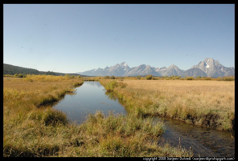
was interesting view. The Tetons reflected well in the perfectly calm
water of the lake. The dam by itself was pretty short but an interesting
fixture in a national park. From there we went ahead to the Mount Signal
outlook. Mount Signal is a tall mountain and a road winds by its side to
almost the very top. It is a steep, slow climb. At the very top, we
stopped the car and got out to take a look. We were standing on top of the
mountain and around us was an amazing scene. The mountain where we stood
was green. The sides of the mountain right beneath us were however mostly
covered with sagebrush. The mountain side disappeared quickly and gave way
to a huge plain. The plain was green and dry in patches. In places there
were huge depressions filled with water. "These depressions were formed by
glaciel ice long back", a sign said. The ice of long back had shaped the landscape in
front of us. As far as eye could see, the same pattern repeated itself
over and over. Dry flat ground and then patches of trees where the land
rose a little.
From Willows Flats, the next stop was the Jackson lake and Dam. The Dam
was made to help the farmers irrigate the land that they cultivated. It
was interesting view. The Tetons reflected well in the perfectly calm
water of the lake. The dam by itself was pretty short but an interesting
fixture in a national park. From there we went ahead to the Mount Signal
outlook. Mount Signal is a tall mountain and a road winds by its side to
almost the very top. It is a steep, slow climb. At the very top, we
stopped the car and got out to take a look. We were standing on top of the
mountain and around us was an amazing scene. The mountain where we stood
was green. The sides of the mountain right beneath us were however mostly
covered with sagebrush. The mountain side disappeared quickly and gave way
to a huge plain. The plain was green and dry in patches. In places there
were huge depressions filled with water. "These depressions were formed by
glaciel ice long back", a sign said. The ice of long back had shaped the landscape in
front of us. As far as eye could see, the same pattern repeated itself
over and over. Dry flat ground and then patches of trees where the land
rose a little.

|
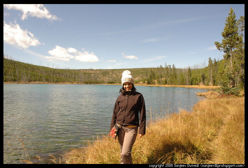
Leaving Mount Signal, we headed to the Jenny Lake area. Previously, I had planned for us to stay at the Jenny Lake campground. The newsletter had however said that Jenny Lake only had 50 campsites and they all fill by 11:00am, so I had not taken the risk. Colter bay campground where we stayed has about 360 campsites in contrast. By this time, it was early afternoon, so we stopped at the north Jenny Lake picnic area and had our lunch. We drove around the Jenny lake on its two mile scenic road. This is probably the single most beautiful lake in Grand Tetons. The water in this lake is crystal clear. There are cruise tours of this lake starting at the north end, but we did not have time for it.
We continued on to our next stop, the Menor's Ferry area. In the olden times before the park was established, a guy named Menor had a ferry that would let the people cross the river over here. From the description in the handout that the ranger had provided to us at the visitor center, Menor's ferry area seemed sort of uninteresting. The area was however covered by trees which were now all yellow and orange, showing their fall colors, so we decided to stop over there. I am sort of glad we did. There were a few log cabins here and we strolled through them. Apparently, a Texan millionaire "Jackson" had, on the advise of the then National Park director, bought a lot of land around the then Grand Tetons National Park and was attempting to donate the land to the Federal Government so thta it could be merged into the park. He waited for a number of years for the government to accept his donation, but the government would not do so. He eventually got tired of the negligence and sent a letter to the then president of United States, Roosevelt. He said what he was attempting to do and if the government did not want the land, he was going to dispose it whichever way possible as it was a major expense on him to maintain the land and pay taxes on it. Roosevelt, in turn, accepted the donation and made it part of the Grand Tetons. The congress next year attempted to rescind the protected status of this land, but Roosevelt vetoed this attempt and let the area be a National Park. The locals call this area, the "Jackson Hole" in respect of Jackson's contribution.
After this stop, the next step was the big visitor center. We stopped there for a little while and bought a small illustrated book by a local author for Nivi. The book contained a lot of water color illustrations of the Tetons area. Nivi is very interested and fascinated by paintings and drawings so it was a good souvenier for her.
 The next stop was a place called "Antelope flats." "The area is abundant
with Bison, antelopes and in general other wildlife", the handout said.
We kept going on the road, until it ended up on a gravel road. I was not
willing to travel on the gravel road, so I stopped. We did not spot so
much as a bird at this place. There were huge willow forest here though,
very yellow and very beautiful and very interesting. We took a few
pictures and headed on.
The next stop was a place called "Antelope flats." "The area is abundant
with Bison, antelopes and in general other wildlife", the handout said.
We kept going on the road, until it ended up on a gravel road. I was not
willing to travel on the gravel road, so I stopped. We did not spot so
much as a bird at this place. There were huge willow forest here though,
very yellow and very beautiful and very interesting. We took a few
pictures and headed on.
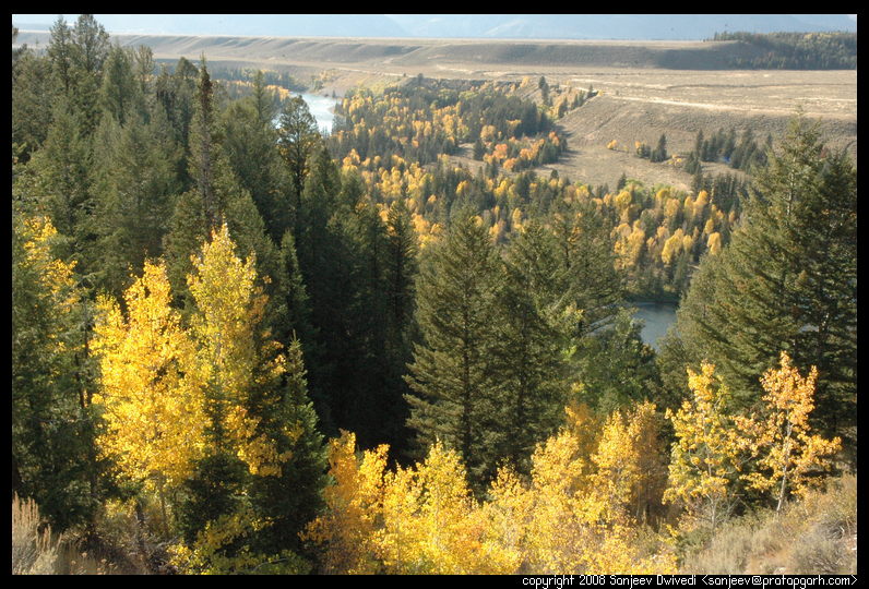
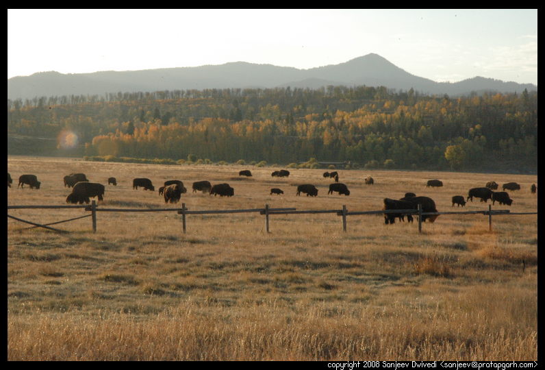
The rest of the journey was pretty quick as the sun was heading downwards. We stopped at a bunch of places in the middle. On the way we saw huge herds of Bison and deer. The snake river was constantly by our side. It was amazing to see a large dry bushy area around us and then bright yellow trees erupting out of nowhere right by the side of the snake river.

|
As we got close to our campground, one of the last places we stopped was this outlook called Oxbow bend. The handout said that we should stop here as wildlife often roams around here. As I found the place and attempted to find a parking spot, it became apparent that something was happening here. Something exciting. People with immense lenses were running around, the cameras and lenses attached to huge tripods. "Moose", a whisper reached my ears. I did not see a moose, so I started roaming about when people a couple feet away started getting excited. Then we saw a moose head in the distance emerging out of the bush. I tried taking a few pictures using my broken camera, but my camera was declaring that it was night already, so I gave up after a few tries and we continued on to the campground.

|
 On the morning of Sep 27, we woke up early again. Since there was only one day
with us to drive to the Craters of the Moon and to see it too, we were in a bit of
a hurry. Originally, the night before I had planned for us to start at 6:00am,
but as is usual, we woke up at 6:30am and broke camp by 7:30am. Packing all
the layers of bedding, tent, rainflys and the tarp and all the other takes a
significant amount of time. Anyways, at 7:30am, while the rest of the campers
slept, we started the engines and bid goodbye to the Colter bay campground.
On the morning of Sep 27, we woke up early again. Since there was only one day
with us to drive to the Craters of the Moon and to see it too, we were in a bit of
a hurry. Originally, the night before I had planned for us to start at 6:00am,
but as is usual, we woke up at 6:30am and broke camp by 7:30am. Packing all
the layers of bedding, tent, rainflys and the tarp and all the other takes a
significant amount of time. Anyways, at 7:30am, while the rest of the campers
slept, we started the engines and bid goodbye to the Colter bay campground.
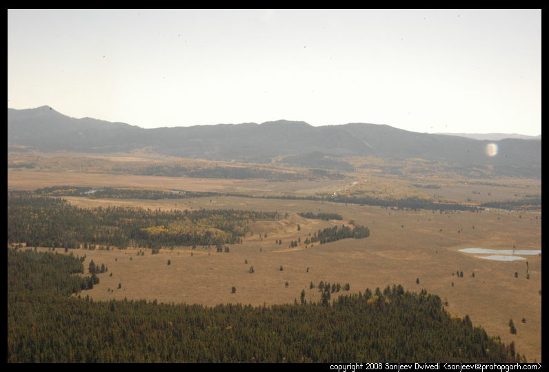
The Grand Tetons national park is an oblong national park and is probably about 30 miles in length. So, pretty soon, within next half an hour we were out of the park and on to the next stop about 5 hours away. Sufficient to say that this was a long long drive. We crossed over from Wyoming to Idaho pretty quickly as Grand Tetons is very close to the border of the two states. The scenery along the highway was very beautiful. One of the highways we traveled on was an Idaho scenic byway. Idaho has quite a few scenic byways which present beautiful scenery along the road. We stopped along a rest area which was located right next to the Snake river and offered some gorgeous views of the snake river. Nivi was getting hungry and so was I, but the highway that we were on did not have a rest area. We kept driving and except for occasional pullovers to the side of the road there was nothing. Nivi was amazed with the amount of land that America has and even more with the fact that there is so much wilderness with nothing and no one in sight. We would occasionally cross a truck or two but apart from that we did not see anything much. Once in a while though, in middle of nowhere, there would be a sign stating that some trail started there. It was hard for me to imagine that anyone would come down there to hike, but I guess someone does.
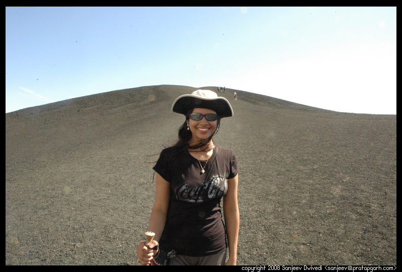
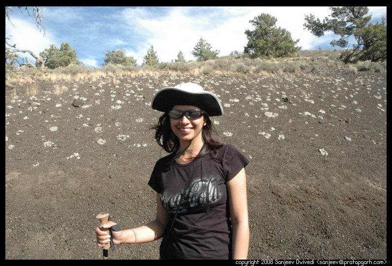
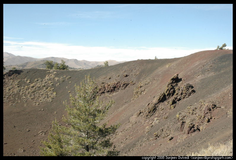
As we approached Craters of the Moon after 5 hours of driving, we were both very hungry as we had yet not have had our lunch. As we entered the park and located the visitor center, we looked around. It was a dark black, mostly barren place. At the visitor center, we inquired about the campsites. The gentleman at the counter shook his head, "Well, all our campgrounds are closed for repair." A dark shadow started looming in my head filled with where we were going to spend our night in middle of nowhere. "However, we still have a few campsites right by the entrances", he continued and my mood immediately lifted. "How much do you charge per night", I asked. "Oh, we don't provide flush toilets and water at these makeshift campsites, so it is free. However, you should get all the water you want to drink before 6:00pm from the visitor center as there is no other source", he said. "Any big animals here?", I inquired. "Bears and Mountain Lions", but they are seldom, if ever seen, so we don't require you to keep the food in the car or have bearproof boxes. Just keep your car closed to keep the chipmunks out." I quickly ran over to the campsites he had mentioned. True to what he had said, these indeed were makeshift campgrounds. Probably it was a picnic area which they had temporarily converted to a campground. There were about 5 campsites. I took the 5th one away from the only other occupied site. It was dry, bone dry, so there was not much point putting the rainfly, but there was a lot of wind. Hmm, wind and dry = dust. Dust getting in tent is not good, so I put the rainfly on top nevertheless. We had the only campsite with a small tree next to ours. There was a chipmunk sitting at the base looking at us. As soon as we arrived close to it, it ran for its life. We cooked some rice and had some of the Chole (Chana Masala) that we had cooked the night before. Having secured our campsite and having had some food, we were now ready to explore the park. It was almost 1:00pm by now. After the lunch, we headed back to the visitor center which was about 200 meters from where we were camping. "Can you suggest about 6-8 miles of hikes in total that explore this park", I asked the girl manning the desk now. "Wow", she said and she suggested a few good hikes of varying lengths. When we came out, I looked at the thermometer in my car, 81 degrees Farenheit, it said and it instantly became clear as to why the girl at the visitor center had exclaimed "wow." It would be brutal to hike about 8 miles in this park with this much heat, especially given that there was absolutely no tree cover anywhere to get some shade. I was getting dubious about how much we would walk. Before starting here, I filled up both of our gallon water containers and the other two 1 litre bottles that we carry on our hikes. "We should return back to the visitor center by 5:30pm and fill the water up", I told Nivi. She nodded her head understandingly.
There is only one road in the park (actually national monument.) First it goes for about a mile or so of two way traffic and then it ends up in a one way loop. The roads in this park have no shoulder whatsoever. There is a little bit of concrete barrier on either sides of the road, so if you get distracted for even a few seconds, you will hit these. Considering that the scenery around was otherworldly, it was hard to focus on the road and so one time I almost hit the barrier. I got more careful and kept my eyes solely on the road from there on.

|
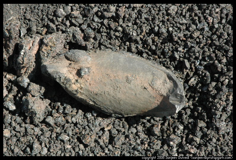
 The next stop were some spatter cones. Spatter cones are cones that are
formed when lava shoots out of the ground under some pressure, so it goes
up a little, but not too high, the lava thus starts forming a cone like
structure from the place where it is seeping. Huge blobs of lava jump up a
few feet in the air and then fall and form rough edged cones. In one such
cone, we saw ice about 10 feet down. The light lava rock is a good
insulator and the sun rarely, if ever shines directly through the shaft of
the cone, thus, even though the temperatures outside go up to 150 F in
summers, the ice never melts.
The next stop were some spatter cones. Spatter cones are cones that are
formed when lava shoots out of the ground under some pressure, so it goes
up a little, but not too high, the lava thus starts forming a cone like
structure from the place where it is seeping. Huge blobs of lava jump up a
few feet in the air and then fall and form rough edged cones. In one such
cone, we saw ice about 10 feet down. The light lava rock is a good
insulator and the sun rarely, if ever shines directly through the shaft of
the cone, thus, even though the temperatures outside go up to 150 F in
summers, the ice never melts.
|
|
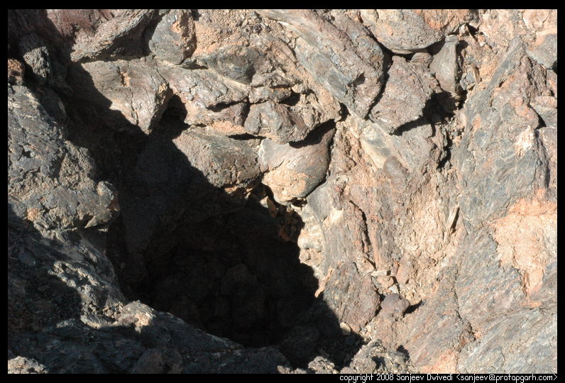
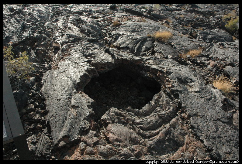
From there, we went to the next stop, which was lava tubes and lava
fields. The trail here snaked its way through a paved winding walkway.
There were huge lava fields on both sides. There were folds of lava, huge
boulders of lava. The lava looked like it could come to life anytime and
start flowing again. On our way, we read some interpretive signs. The
interpretive signs said that lava tubes are tubes of lava as the name
suggests. As lava flows through the crevices in the ground, the outer
surface of the lava cools down and becomes solid. The innards of the tube
however are still hot and they transport lava from its source to far away
places, sometimes miles away. The exceptional insulation of the lava tube
lets the lava travel great distances without losing any heat. As the lava
flow stops however, the lava tube's final destiny is to collapse. Some
lava tubes collapse when they are still soft and soggy with the hot lava.
They form huge crater like depressions in the lava field. Others collapse
after a while when they are hard and brittle. They form huge room like
structures separated by the debris of the fallen roofs. We entered one
such tube called the Indian cave. The roof in this lava tube has
collapsed in several places so it is reasonably well lit, and hence you don't
need a flashlight to walk through it. As we walked through it, we saw
some huge boulders even in places where the roof was intact. On closer
examination we could see molds in the roof which matched the dimensions
of the boulders. Apparently, the boulders had fallen off the roof at some
point of time!
There were two other caves that we wanted to see. On reaching the entrances though, we found that we had to crawl through the entrance, that it was dark, icy and slippery inside and that it was not advisable until you knew what you were doing to enter these caves. We were not prepared for these caves, so we headed back. By this time it was close to 5:30pm, so from there we headed to the visitor center. After filling up the water, we entered the park again for one last place that we wanted to see. This place was called the Devil's Orchard. An accessible paved walkway runs through a small garden of huge rocks. A holy man once looked at this place and called it an orchard worthy of the Devil himself and the name just stuck.
Walking in the sun all day we were tired and hungry by now. Also, the sun had started going down quite a bit, so we headed back to our tent. We rested in the tent for a little while and when we felt refreshed, I fired up my trusty stove in the shade of the tent. The wind was slowing down somewhat and the shade of the hills was slowly creeping over our tent. The pressure cooker was humming gently sitting on top of the stove and the aroma of cooking rice was wafting in the air. A few other people had set up their tents close by. We had our dinner and we sat and talked for a little while on our experience so far. Nivi was happy and content. We went to bed at about 8:00pm.
As we woke up, the sun was already shining. We packed our tent and went to the visitor center to get refreshed. We returned back to the campsite and cooked some noodles. We had our fill and then we started on the journey back to home. It was just a lot of driving. The place that I had decided to stop on our way back was not on the route the GPS thought was the best, so we started considering other places to stay. I had originally thought that we would stay one night in a motel on the way back as I could not locate a campground close to the roads I had planned to take on the way back, but as we reached Oregon, and located the welcome center, I had other ideas. The lady at the welcome center quickly handed us a map and a few brochures and told us of 3 possible campgrounds, all with showers on our way. We kept driving and towards evening, stopped at Emigrant Springs campground in Oregon. This campground was right by the side of the highway. Literally! we could see and hear the cars zipping by. It was a well equipped campground however, and we had our showers here. We cooked, we ate, and for the first time on this trip, I got some wood and we made campfire. After all these nights of eating in the cold evening, this one was a pleasant change. We sat by the fire for a while and talked under the clear sky and the stars.

|
It was mostly just a drive, except for stopping by the Sacagawea state park at the confluence of the Snake and the Columbia rivers. Nivi very desperately wanted to locate a Washington state welcome center so we could find information about Washington campgrounds just the way the Oregon welcome center had provided. Unfortunately, we could not locate any such place. The Sacagawea state park however had a visitor center and the lady there provided us with similar details. A lot more drive later, we were back to home at about 3:00pm in the evening and thus ended our long road trip.